Georeferencing Trail Maps for PDF Maps on iOS
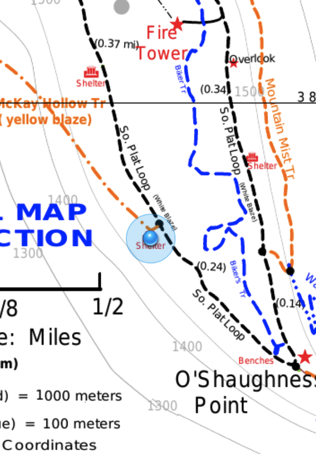
When I first got an iPhone, one of the first app ideas I had was one that would let me take a trail map image, mark a few known coordinates, then use the GPS to display the blue dot like in the built-in Maps app. I've searched for something similar a few times, and had actually started doing some research into libraries for doing the math. This weekend, I thought I'd search one more time, and there was actually a free app recently posted called PDF Maps by Avenza.